

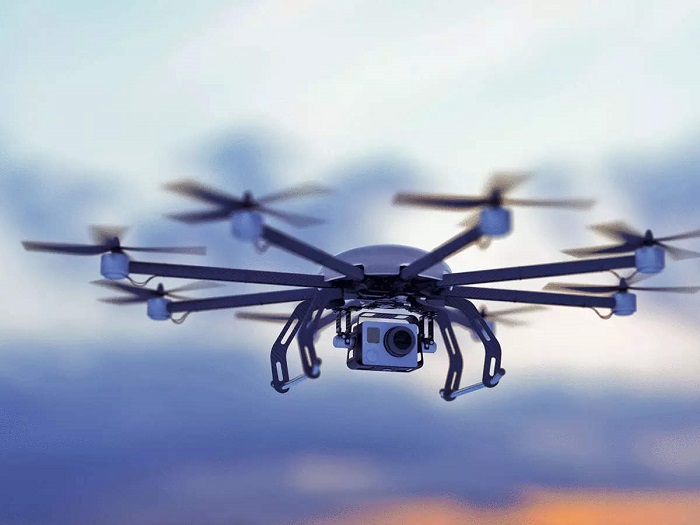
The future of package delivery, taxis, and even takeout in cities may be in the air—above the gridlocked streets. But before a pizza-delivery drone can land safely on your doorstep, the operators of these urban aircraft will need extremely high-resolution forecasts that can predict how weather and buildings interact to create turbulence and the resulting impacts on drones and other small aerial vehicles.
While scientists have been able to run simulations that capture the bewilderingly complex flow of air around buildings in the urban landscape, this process can take days or even weeks on a supercomputing system—a timeline far too slow (and a task far too computationally expensive) to be useful to daily weather forecasters.


Now, scientists at the National Center for Atmospheric Research (NCAR) have demonstrated that a new kind of model built entirely to run on graphical processing units, or GPUs, has the potential to produce useful, street-level forecasts of atmospheric flow in urban areas using far fewer computing resources and on a timeline that makes real-time weather forecasting for drones and other urban aircraft plausible.
The NCAR team describes the use of a microscale model called FastEddy to simulate atmospheric conditions in downtown Dallas.
“GPUs have really matured in recent years, and they hold a lot of potential to accelerate modeling,” said NCAR scientist Domingo Muñoz-Esparza, researcher of the study and one of the principal model developers. “To take maximum advantage of GPUs, we built FastEddy from scratch.”
This study was funded by the National Science Foundation, which is NCAR’s sponsor, the Defense Threat Reduction Agency, Uber Elevate, and NASA. The simulations used for the study were run on the Casper system at the NCAR-Wyoming Supercomputing Center.
Traditional weather forecasts are often run at a resolution of about 10 to 15 kilometers (six to nine miles), meaning that anything smaller than that—buildings, streets, and any of the other complexities of the urban landscape—are not directly captured. Even high-resolution weather models are run with a spacing of 3–4 kilometers (1.8–2.5 miles) between grid points, which can reduce entire towns to a handful of pixels.
The FastEddy model, on the other hand, can be efficiently run at a resolution of just 5 meters (16 feet), fine enough to accurately simulate the swirling eddies and other turbulent flow features that arise in the wakes of buildings and in street canyons. Other models, including NCAR’s Weather Research and Forecasting Large Eddy Simulations (WRF-LES) modeling system, can also produce similarly high-resolution simulations, but they use vastly more computing resources. These traditional simulations are highly detailed and remain important for basic research, but they are not practical for day-to-day forecasting.
WRF-LES and other similar models rely on more traditional computer chips, known as central processing units. CPUs excel at performing multiple tasks, including control, logic, and device-management operations, but their ability to perform fast arithmetic calculations is limited. GPUs are the opposite. Originally designed to render 3D video games, GPUs are capable of fewer tasks than CPUs, but they are specially designed to perform mathematical calculations very rapidly.
To benefit from the increased speed offered by GPUs, NCAR and other modeling institutions are working to retrofit existing modeling code—including NCAR’s Model for Prediction Across Scales, a global weather model—to partially use GPUs. The result can be more efficient and faster than the original versions, but there will always be lingering inefficiencies due to bottlenecks created by the CPUs in these hybrid approaches. To take full advantage of the promise of GPU acceleration, a model’s code must be written so that all the model’s calculations are performed by GPUs.
FastEddy was written from the ground up, primarily by NCAR scientists Jeremy Sauer and Domingo Muñoz-Esparza, to do just this. The result is a model that has a prediction rate that is six times faster under similar power consumption—or a power consumption that is eight times lower for the same prediction rate—than an equivalent CPU model.
“If you want to do microscale forecasting in real-time, you need to be as fast as the GPUs can be,” Muñoz-Esparza said.
A change in the winds: Shifting building wakes
For the new study, the scientists used FastEddy to simulate the urban weather in downtown Dallas for over 50 selected weather scenarios in 2018. The results confirmed the potential dangers of relying solely on significantly coarser-resolution weather forecasts for aerial operations in the “urban canopy.”
For example, the scientists found that in the afternoon, when Sun-heated air at the surface is rising, cooling, and falling again, creating a vertical circulation, the winds in the urban canopy at 26 meters (or 85 feet) above the ground tend to be aligned with large-scale background wind direction at the same height. But at night and in the early morning, when the atmosphere is more stable, the winds through the urban canopy are actually offset from the direction of the large-scale background winds. In fact, the wakes behind the buildings can shift up to 45 degrees clockwise from the direction of the incoming weather.
Broadly, the modeling effort also showed how the weather in the urban canopy changes, on average, through the seasons, but also those individual days can display marked variation within the same month, and even within the same 24-hour period, underscoring the importance of real-time forecasts rather than relying on averages.
Such forecasts could help aircraft operators determine whether they can safely accomplish their objectives, as well as how much battery charge will be needed. Turbulence in the urban canopy can cause batteries to drain as much three times faster than they otherwise would, according to Muñoz-Esparza, which could leave an aircraft stranded in the city.
Beyond modeling turbulence and wind direction in the urban canopy, the FastEddy team is working on other possible applications for the model, including a new project to model how the sound produced by air taxis might propagate through a city.
They are also working at adding more detail and more physics into the model. For the Dallas experiment, the model runs were kicked off using the output from a traditional weather model with a resolution of 3 kilometers (1.8 miles), including wind velocity and direction, as well temperature. FastEddy then took those large-scale variables and downsized them to simulate the microscale atmospheric flows.
Now the FastEddy team is working to extend the model’s capability by adding moist dynamics and clouds, which will make these microscale weather predictions even more realistic. In addition, the extraordinary efficiency of FastEddy makes it possible to run the model multiple times for the same period, a technique known as ensemble forecasting. This allows scientists to have a better understanding of how certain (or uncertain) a forecast is and to generally provide more robust and reliable guidance to aircraft operators.
“We want to have the possibility down the road of a full weather forecast but at the microscale—something complete,” Muñoz-Esparza said. “It’s a really exciting time to be involved with this kind of GPU model. There’s so much potential.”